|
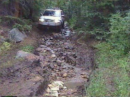
The road headed down to creek level again but didnt actually cross it. The route going down had lots of running water and more boulders buried in the muck. After a short run beside the creek, the road turned uphill. That climb took several tries. It was so slippery, I kept sliding toward a tree. I wonder if that was the tree Trapdoor liked so much.
Once I reached the higher level, the road split. I glanced at the computer screen to see what Street Atlas had to offer. The program did not show the road, however, it did show the creek and the obvious route to take would be the one following the creek. I turned left which took several tries due to the density of the forest at that point. In some places, there wasnt much room between the trees, even for a Rodeo.
Once again, the road dropped to creek level and made a sharp right turn between two more trees. It crossed the creek and began following the north bank. By that time, all my daylight was gone, however, there was still enough dusk left that I could make out shadows without turning on the headlights.
|
 |

